Your journey begins here — explore what makes us different.
At GRED, We deliver cutting-edge GIS and Remote Sensing education, meticulously designed to be highly relevant to industry demands.
GRED Institute provides robust career support including resume building, interview preparation, and direct access to our extensive network of industry partners and government agencies.
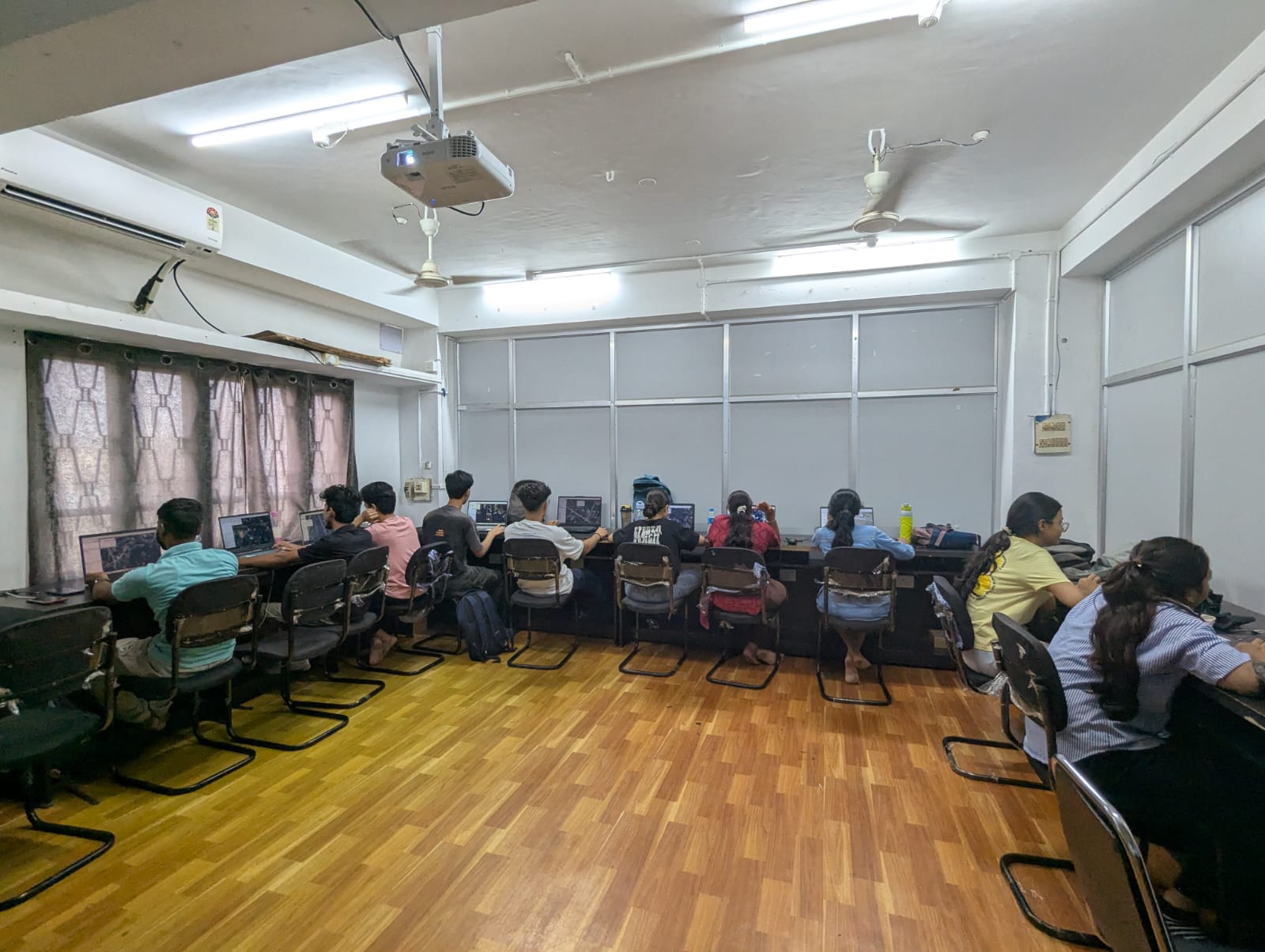
Our campus features Smart AC Classrooms equipped with modern audio-visual technology all supported by high-speed Wi-Fi, providing the perfect foundation for hands-on, immersive learning.
Beyond technical training, we offer comprehensive student support through dedicated doubt-clearing sessions, personalized mentorship from expert faculty, and regular performance evaluations.
At GRED Institute, we are committed to providing an exceptional learning environment that fosters skill development, professional growth, and real-world readiness. Here’s what sets us apart as the premier destination for GIS and Remote Sensing education in Northeast India
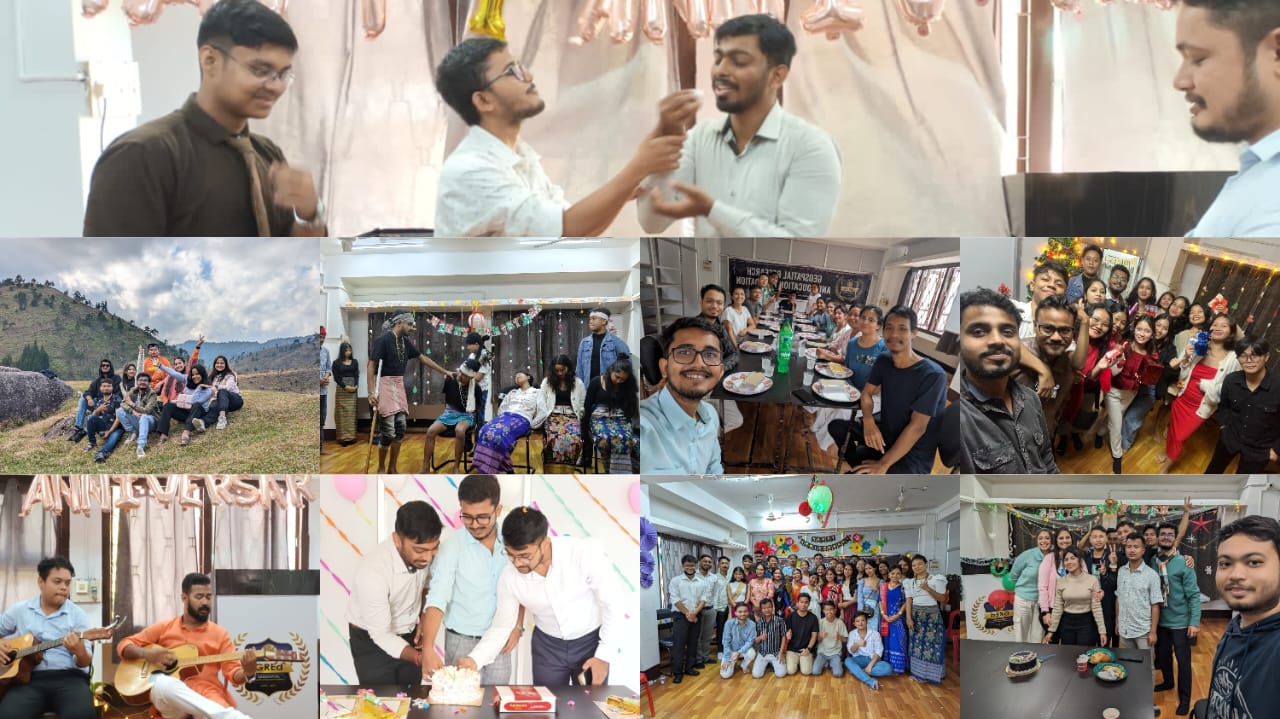
GRED Institute fosters a vibrant Campus Life where learning extends beyond academics. Engage in dynamic field trips, lively social events, and collaborative geospatial workshops, building lasting connections within our community. We focus on your holistic development, ensuring a truly memorable and enriching educational experience.
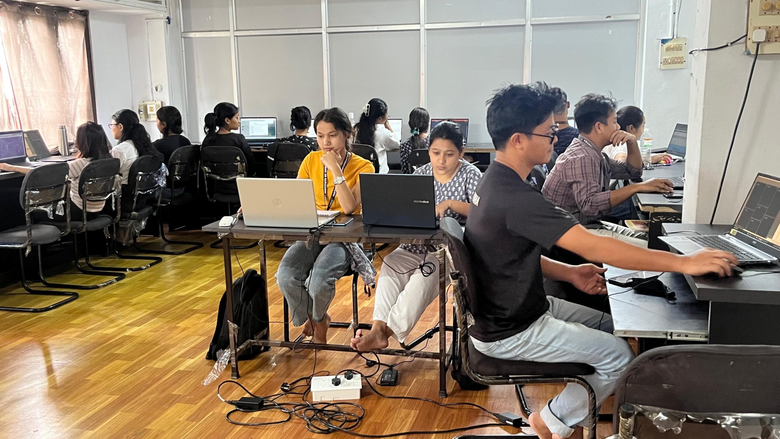
Learn in comfort and with cutting-edge technology. Our Smart AC Classrooms are designed to enhance your learning experience with modern audio-visual aids, interactive displays, and a comfortable, air-conditioned environment. This ensures an optimal setting for intense practical sessions and engaging theoretical discussions in GIS and Remote Sensing.

Learn from the best in the field. Our faculty comprises Certified Trainers and seasoned Industry Experts with extensive experience in GIS, Remote Sensing, and various geospatial applications. They bring real-world project insights and practical knowledge into the classroom, ensuring you receive up-to-date, relevant, and industry-focused training that sets you apart as a skilled geospatial professional.
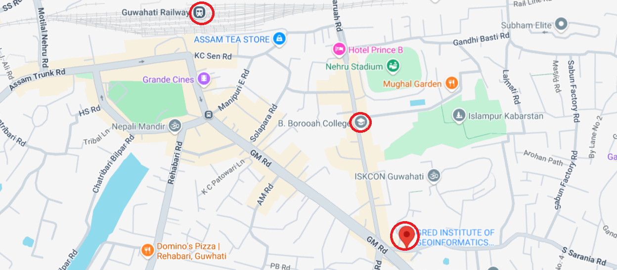
Our institute boasts a prime location in Guwahati, Assam, conveniently situated nearby to the main railway station and surrounded by numerous colleges. This strategic placement offers easy accessibility for students commuting from various parts of Guwahati and beyond, making GRED Institute an ideal and convenient choice for your geospatial education.
Bridge the gap between classroom learning and industry practice with our robust Internship Opportunities. GRED Institute leverages its strong industry partnerships across the geospatial sector in Northeast India to provide students with invaluable hands-on experience. These internships allow you to apply your GIS and Remote Sensing skills on real-world projects, boosting your resume and career prospects significantly.
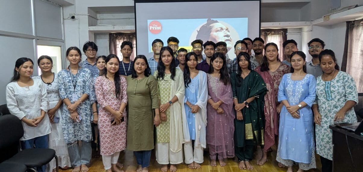
Join a thriving community of successful geospatial professionals through our Strong Alumni Network. GRED graduates are making significant contributions in various sectors across India, particularly in Northeast India. Our alumni actively engage with current students through mentorship, guest lectures, and career support, providing invaluable insights and networking opportunities that extend far beyond your time at the institute.

Welcome to the GRED Institute of Geoinformatics, a beacon of practical geospatial education established in 2021. Nestled in the heart of Guwahati, Assam, we embarked on a mission to empower individuals with the transformative power of Geographic Information Systems (GIS) and Remote Sensing. As a pioneering force in Northeast India, GRED Institute stands committed to delivering cutting-edge, job-oriented training that directly addresses the evolving demands of the global and regional geospatial industry.
At the core of GRED Institute is a deep-seated belief that education must translate into tangible skills and real-world impact. Operating under the guiding principles of the Geospatial Research and Education Foundation (GREd Foundation), our vision is to cultivate a new generation of highly skilled GIS and Remote Sensing professionals ready to drive innovation and solve complex challenges. We dedicate ourselves to crafting a curriculum that is not just current, but forward-looking, ensuring our graduates are sought after for their proficiency and problem-solving capabilities.
Geographic Information Systems (GIS) and Remote Sensing (RS) are powerful technologies for analyzing, visualizing, and managing spatial data. They are crucial for understanding everything from climate change and urban planning to disaster response and business logistics. It's a rapidly expanding field, creating a high demand for skilled professionals across virtually every sector.
ur programs prepare you for diverse roles such as GIS Analyst, Remote Sensing Specialist, Cartographer, Geospatial Developer, GIS Project Manager, Data Scientist (Geospatial), Photogrammetrist, and specialists in environmental management, urban planning, and disaster management.
Absolutely. With increasing focus on smart city development, infrastructure projects, environmental management, and disaster resilience, the demand for skilled GIS professionals in Northeast India is rapidly growing. Government departments (like NESAC, Survey Dept. Assam, Disaster Management Assam, Land Records Dept. Assam) and private firms in the region are actively seeking geospatial talent.
GIS skills are highly sought after across a wide spectrum of industries including: Government (local, state, national), Urban Development, Environmental Consulting, Disaster Management, Agriculture & Forestry, Defense, Utilities, Transportation, IT Services, Healthcare, Real Estate, and Research & Academia.
GRED Institute, under the aegis of Geospatial Research and Education Foundation, stands out due to its:
* ISO 9001:2015 Certification and independence for dynamic, industry-aligned syllabi.
* Intensive Hands-on Training with cutting-edge software like ArcGIS Pro, QGIS, ERDAS Imagine, Google Earth Engine, and Python.
* Expert Faculty who are certified trainers and industry veterans.
* Strong Industry Partnerships for unparalleled internship and placement opportunities. * Focus on real-world applications relevant to Northeast India.
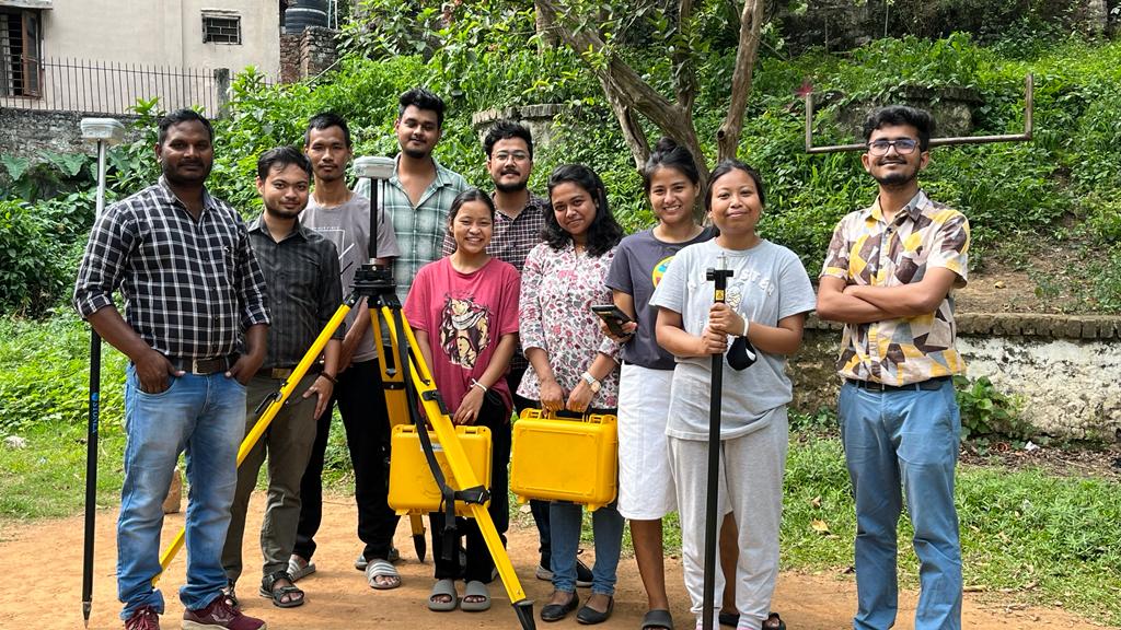
Our methodology is highly practical and student-centric. We emphasize hands-on lab sessions, real-world project work, field activities (e.g., drone & DGPS surveys), and dedicated doubt-clearing sessions. Our Smart AC Classrooms and state-of-the-art labs with high-speed Wi-Fi provide an optimal learning environment.
No! Our Post Graduate Diploma in Advanced GIS & Remote Sensing is open to any graduate, regardless of their academic background. This includes Bachelor's, Post-Graduate, M.Phil., Ph.D., B.Tech., B.A., and all other disciplines. The curriculum is designed to build your expertise from the ground up.
ou'll receive comprehensive support including: * Dedicated doubt clearing sessions with faculty. * Periodic evaluations to track your progress. * Guidance from Program Coordinators on academic and general queries. * Access to modern labs, high-speed Wi-Fi, and extensive learning resources. * Continuous mentorship from certified trainers.
Yes, a laptop is mandatory. The minimum recommended configuration includes: Windows 10/11 (64-bit), Intel Core i5 (8th Gen+) or AMD Ryzen 5 (2000+), 8 GB RAM (16 GB recommended), 256 GB SSD (512 GB recommended), and integrated graphics (dedicated GPU with 2GB VRAM recommended).
We provide robust placement assistance, including: resume building workshops, mock interviews, career counseling, organizing recruitment drives, and actively connecting our graduates with our extensive network of industry partners and government organizations that seek GIS professionals in Assam and across India.
Throughout your course, you will engage in numerous practical projects, case studies, and potentially real-world assignments. These projects form the core of your professional portfolio, showcasing your practical skills in GIS and Remote Sensing to potential employers. Our faculty guide you in building a strong, presentable portfolio.
The geospatial field is constantly evolving. As a member of the GRED Family you can leverage our alumni network for insights into new technologies, benefit from special workshops or advanced modules (if offered), and stay connected for continuous professional development.
The long-term prospects are excellent. GIS and Remote Sensing skills are becoming increasingly integral to various sectors, ensuring sustained demand. With experience and continuous learning, you can advance into leadership roles, specialize in emerging areas like geospatial AI/ML, or even pursue entrepreneurial ventures in the rapidly expanding geospatial market.
GRED boasts a strong and active alumni network, comprising successful Geospatialist working in prominent government and private organizations across India. This network provides invaluable opportunities for mentorship, professional networking, job referrals, and staying connected with the latest industry trends.
Welcome to GRED Institute of Geoinformatics, your premier destination for cutting-edge GIS and Remote Sensing education in Northeast India. We are dedicated to nurturing the next generation of spatial thinkers and problem-solvers, equipping them with the skills to tackle complex challenges from urban planning in Guwahati to environmental conservation across Assam